How we help:
Supply Chain & Landowners
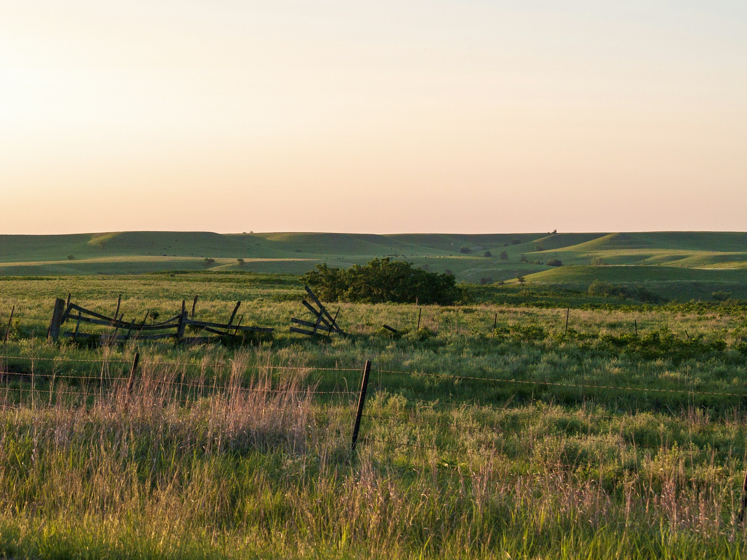
Making Smarter Decisions for The Land We Tend
Globally, our green spaces are facing a perfect storm as we manage the increased demands for food, water and energy of a growing population with the impacts of climate change & instability.
Managing our land, both agricultural and wild, for the benefit of the planet in the face of these threats represents a real challenge. Deep Planet’s remote sensing solutions provide actionable insights at the landscape level, helping us all to make better decisions in the face of adversity.
-
Identify crop boundaries for your target crop at scale to understand the state of the industry in your region, identify supply chain opportunities & assess industry growth. Learn more.
-
Advanced monitoring systems providing real time insights into crop health and vegetation patterns for optimal resource management. Learn more.
-
Comprehensive soil analysis using AI to monitor carbon sequestration, nutrient levels for saving fertiliser costs and benefiting from carbon insetting. Learn more.
-
Ecosystem monitoring solutions that track biodiversity changes and habitat health to support conservation efforts. Learn more.
-
Monitor key climate events in real time (such as flood damage, frost or hail events) to enable accurate reporting & response from private & public entities. Learn more.
Regional Scans & Crop ID
Identify crop boundaries for your target crop at scale to understand the state of the industry in your region, identify supply chain opportunities & assess industry growth.
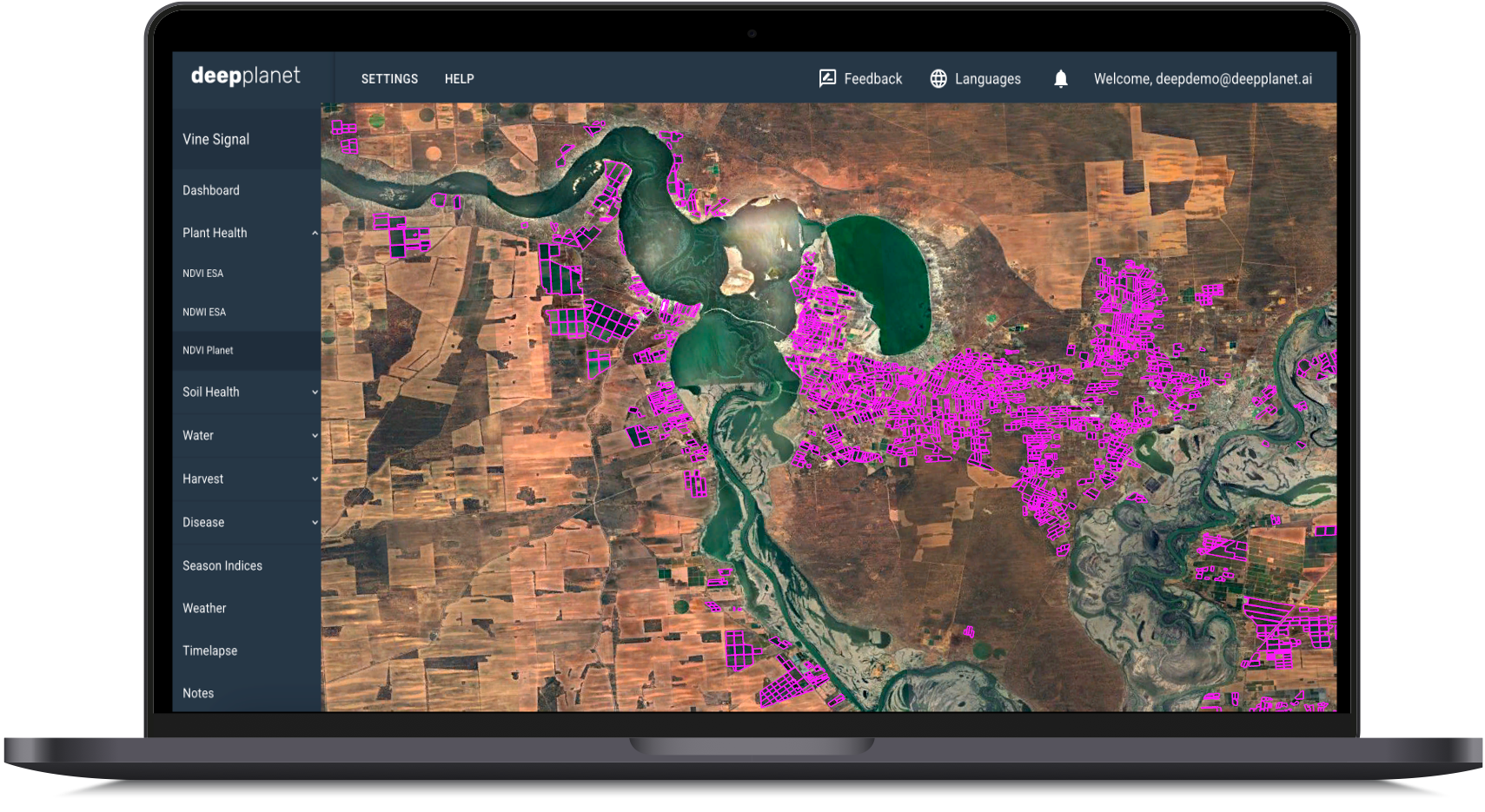
Identify crop boundaries & total area within your region of interest.
Monitor change in crop area over time & identify key risk factors to local productivity.
Aggregate data collection on a regional scale & provide access to insights for individual growers.
“NYWGF is proud to have partnered with Deep Planet, a global Agri Tech company on this report… Their work will be instrumental in building a foundational process by which New York’s vineyard data can be regularly & accurately measured for years to come.”
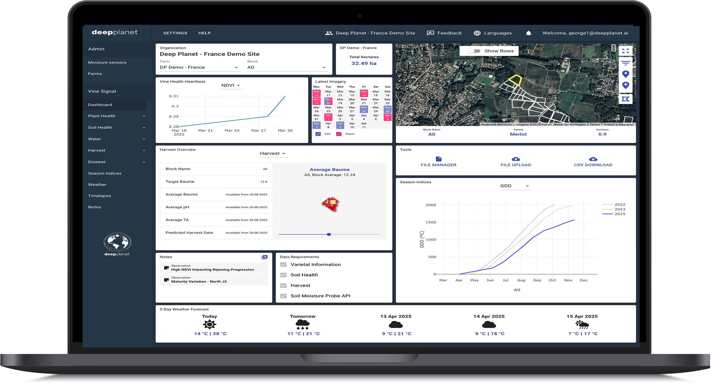
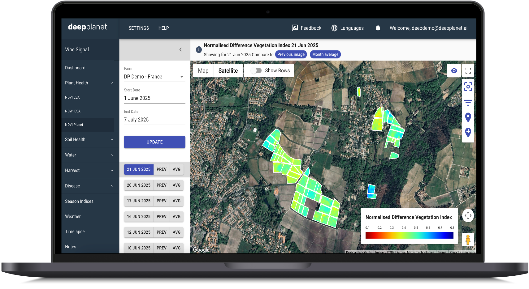
Crop Health Monitoring
Monitor Crop Health with a regular heartbeat of satellite imagery, providing near daily insights into changes in NDVI & NDWI at multiple resolutions. Utilise key seasonal indices to easily compare growing seasons.
Crop level information with 0.5m, 3m & 10m resolution imagery to suit your use case.
Up to daily imagery with NDVI Planet offers a constant stream of analytics at scale.
Faster identification of problems such as irrigation leaks, weather impacts, disease outbreaks, crop damage and more.
“I am able to focus on making quality, organic wine instead of worrying about vineyard health issues. Deep Planet gives me the visibility & intel I need to address any issues in a timely manner.”
Regenerative Agriculture & Sustainability
Monitor Soil Health at scale with satellite imagery. Track three key nutrients & optimize input application with Variable Rate Application maps. Monitor Soil Organic Carbon levels over time & develop sustainable, ongoing carbon projects.
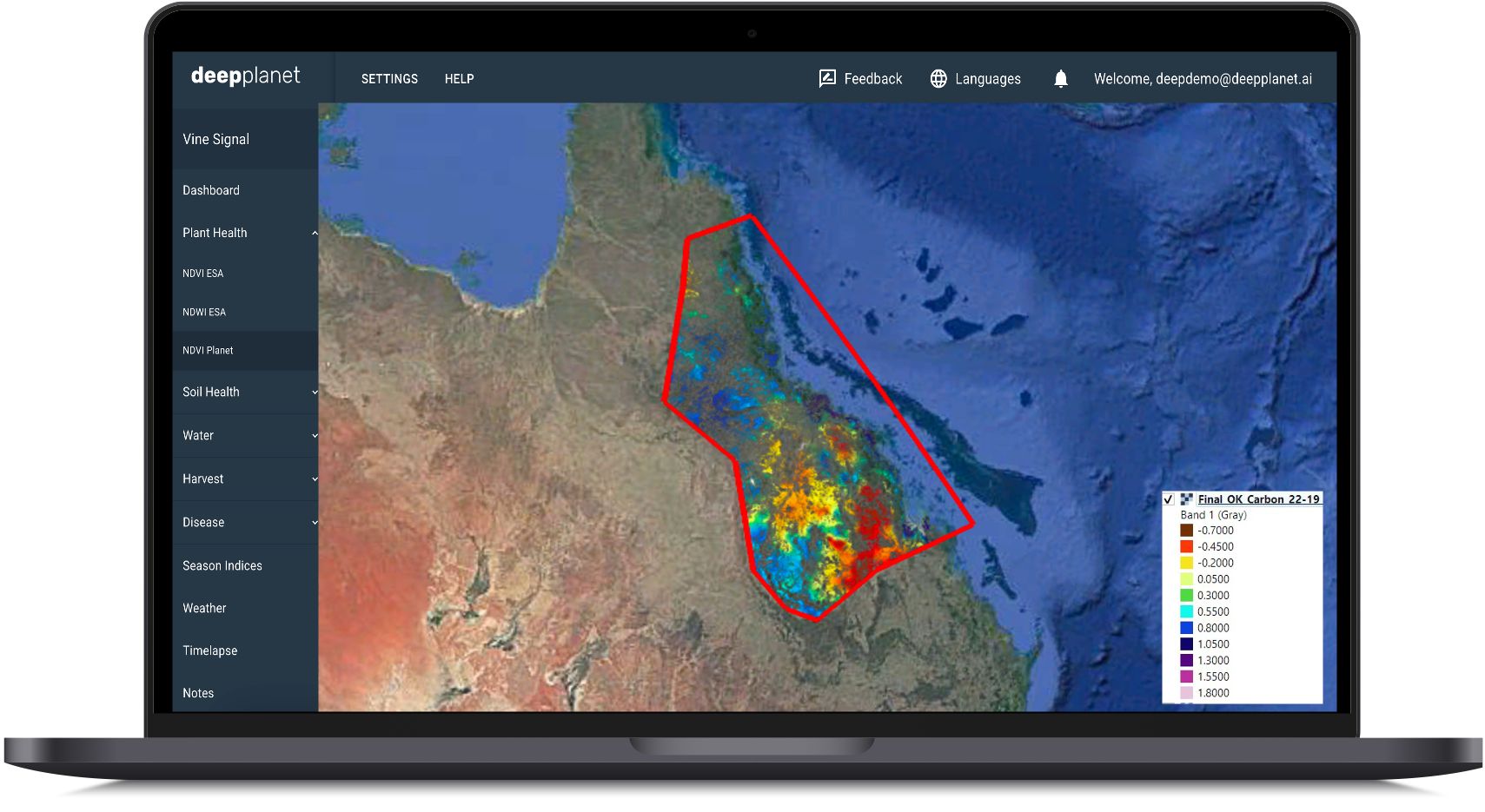
Identify opportunities for regeneration at the landscape level.
Reduce sampling costs associated with large scale carbon projects.
Reduce supplementary fertiliser costs.
Assess analytics on landscape level land-cover changes.
Identify key areas of concern for greater funding.
“Through our partnership with Deep Planet, doTERRA will continue its lifelong commitment to source the healing gifts of the earth intentionally & sustainably, one tree at a time.”
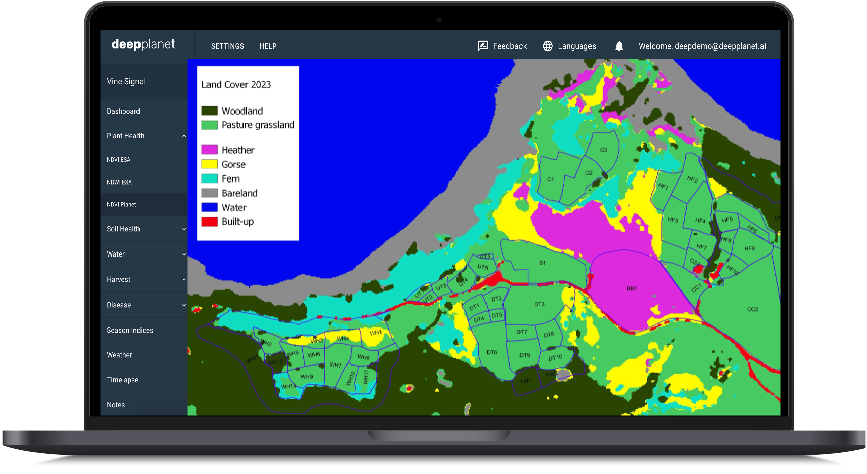
Biodiversity & Habitat Classification
Ecosystem monitoring solutions that track biodiversity changes and habitat health to support conservation efforts.
Classify habitat type at scale with high resolution remote sensing solutions.
Utilise individual species ID to quantify vegetation distribution across the landscape.
Monitor changes in land use & land cover over time, including retrospective assessments, to quantify landscape degradation & conservation opportunities.
Climate Event Analytics
Monitor key climate events in real time (such as flood damage, frost or hail events) to enable accurate reporting & response from private & public entities.

Assess relative damage to date and response required across entire regions.
Identify key regions with greatest risk and implement preemptive management strategies such as natural flood management
Quantitative & visual assessments of the extent and distribution of damage available.